Surfer is a grid-based mapping program that interpolates irregularly spaced XYZ data into a regularly spaced grid. Grids may also be imported from other sources, such as the United States Geological Survey (USGS). The grid is used to produce different types of maps including contour, color relief, and 3D surface maps among others. Many gridding and mapping options are available allowing you to produce the map that best represents your data. Visualize Data You work hard gathering your data. Don’t settle for subpar visualizations. Utilize Surfer’s extensive modeling tools to display your data the way it deserves while maintaining accuracy and precision. Clearly communicate information related to geology, hydrology, environmental, construction and more with Surfer. 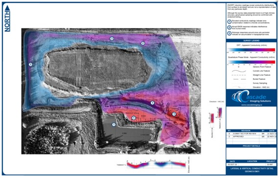
Create Professional Maps for Your Field Easily communicate both simple and complex spatial data. Whether your work pertains to geology, hydrology, construction, the environment or any related industry, Surfer gives you the tools to create high-quality maps to clearly deliver your message to coworkers, clients, and stakeholders alike. 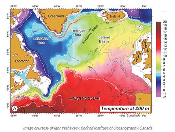
Streamlined Workflows You will be up and running in matter of minutes. Surfer’s user interface was designed to take the guesswork out of learning a new program for users in any industry, from hydrology to construction. We worked hard to streamline workflows so you don’t have to. 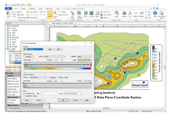
System requirements: |